|
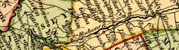
The Middle Atlantic is the gateway to the interior
of North America via the Hudson, Potomac and Delaware rivers. Maps
of North America display the Middle Atlantic region in the larger
continental context from which it cannot be separated.
Looking at the North American maps through time,
we can see the growing road and railroad networks edging westward,
and settlements moving west along the river valleys and early roads
toward the unknown interior.
 |
A new & correct map of the
trading part of the West Indies, 1741.
catalog
record
Yellow tints link the British
Isles with their holdings in the Americas from Canada to Jamaica
and south to Tobago. There are views of Boston, New York,
Mexico, Vera Cruz, Chagre, Porto Bello, Cartagena, Porto Rico,
Panama, and Havana. California is shown as an island.
Porto Bello was captured by Admiral Edward Vernon, to whom
this map is dedicated, in 1739. The capture was not too difficult,
as the Spanish forts protecting the port were in disrepair.
It is said that the victory “caused the people of England
to go mad with excitement and joy.” Medals were cast
with Vernon’s portrait, and “Vernon’s Head”
became a popular pub sign. Vernon is most famous as the inventor
of “grog,” the watered-down rum issued daily in
partial payment to sailors. “Grog” was not well
received at first, as it diluted the former half-pint rations
of pure rum.
|
 |
The English empire in America,
ca. 1685.
catalog
record
From Nathaniel Crouch’s promotional
book, The English Empire in America, this map includes all
the colonies from Newfoundland (inset), New England southward
to Carolina, and barely, but importantly, at the lower right,
includes “Barmudas” (Bermuda), which was part
of the Virginia plantation until 1625. The map is filled with
illustrations despite its very small size. Robert Burton (“R.
B.”) was Crouch’s pseudonym. |
|