|
Atlantic Ocean, ca. 1720.
catalog
record
This beautifully hand-colored 17th-century
nautical chart is most notable for the rhumblines that cover
the face of the map in a web of diagonal lines. These span
out from the brilliantly colored compass roses which dot the
map, and show compass directions. The fleur-de-lis
always points north, and the Maltese cross points east to
the Holy Land. Notice all the early placenames along the Middle
Atlantic shoreline from Philadelphia (founded only 10 years
before this map was published!) to Cape Lookout. |
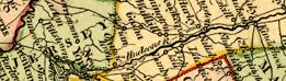
From New York south to
the Chesapeake, the river-laced Middle
Atlantic colonies had easy access to the Atlantic Ocean and
its water links to markets in London and the West Indies.
 |
Atlantic Ocean, 1682.
catalog
record
This is one plate in Atlas Maritimus
. . ., a miniature pocket atlas by John Seller, Hydrographer
to the King (Charles II) in 1682. The atlas was printed by
Ann Godbid, one of a very few women printers in London at
this time. |
|